Farsight Vision unveils navigation module enabling UGVs to operate without GPS
The module includes a laser sensor and integrates with the FSV Platform
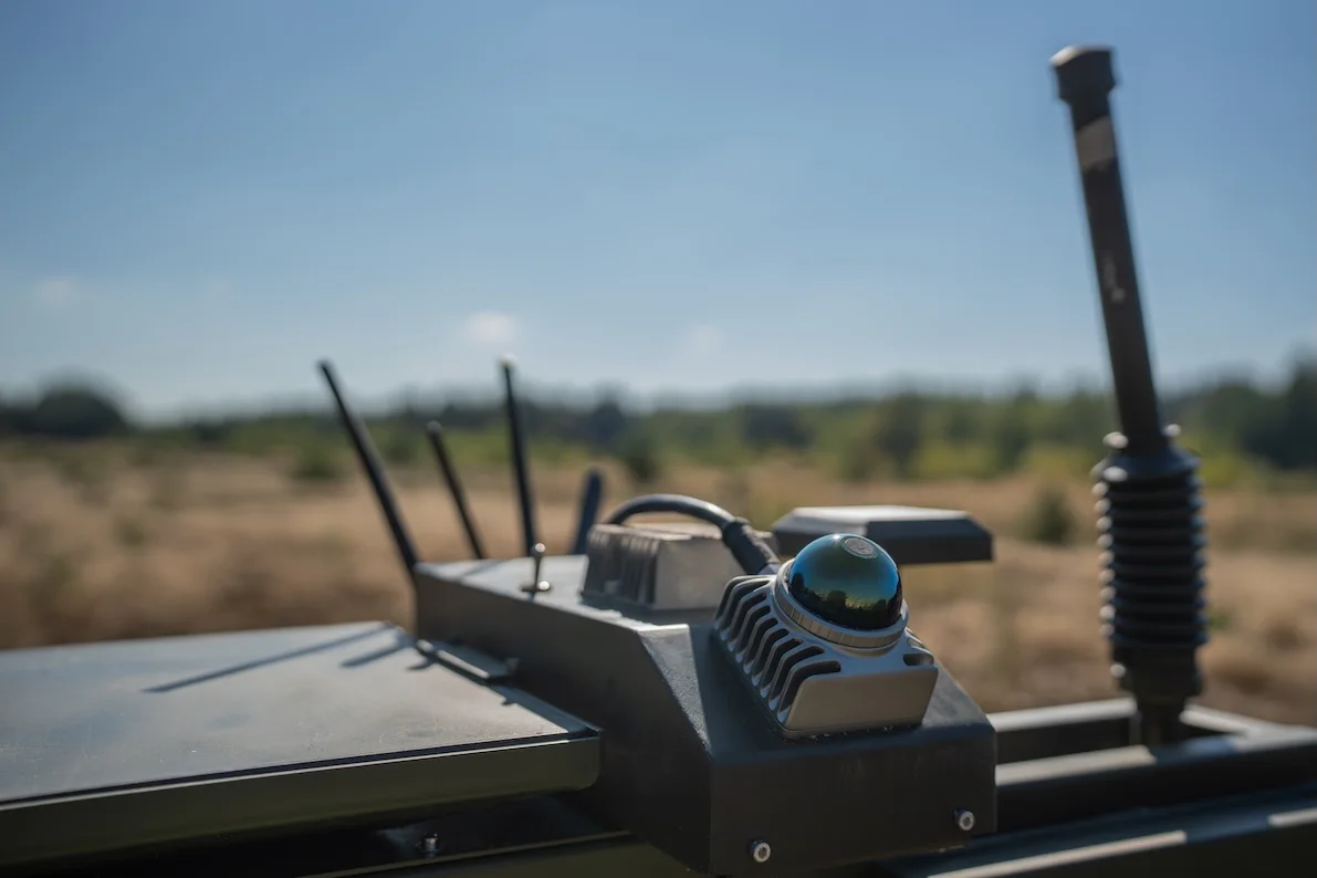
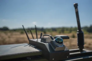
Farsight Vision navigation module. Photo provided by the company
Ukrainian-Estonian developer of software and hardware solutions Farsight Vision has unveiled a new navigation module that enables unmanned ground vehicles (UGVs) to navigate terrain without a GPS signal. The company announced the development in a press release.
Farsight Vision says satellite signal loss and challenging terrain are common challenges for UGV operators and can result in equipment loss or mission failure. The company’s new navigation module reduces this reliance by providing operators with an additional source of spatial data that operates independently of satellite navigation systems.
The solution is based on the concept of a digital twin of the terrain. The module includes a laser sensor and integrates with the FSV Platform. It compares sensor data with a 3D terrain model created in advance on the FSV Platform and generates a real-time point cloud around the UGV. This shows obstacles, pits and other hazards along the route and helps the operator navigate when GPS is unavailable.
The 3D point cloud gives the operator a spatial understanding of the terrain rather than a flat image, the developers say. For example, when approaching a slope, the operator can assess its steepness and determine whether the vehicle can pass. Pits, ledges and other terrain features can be detected in the same way
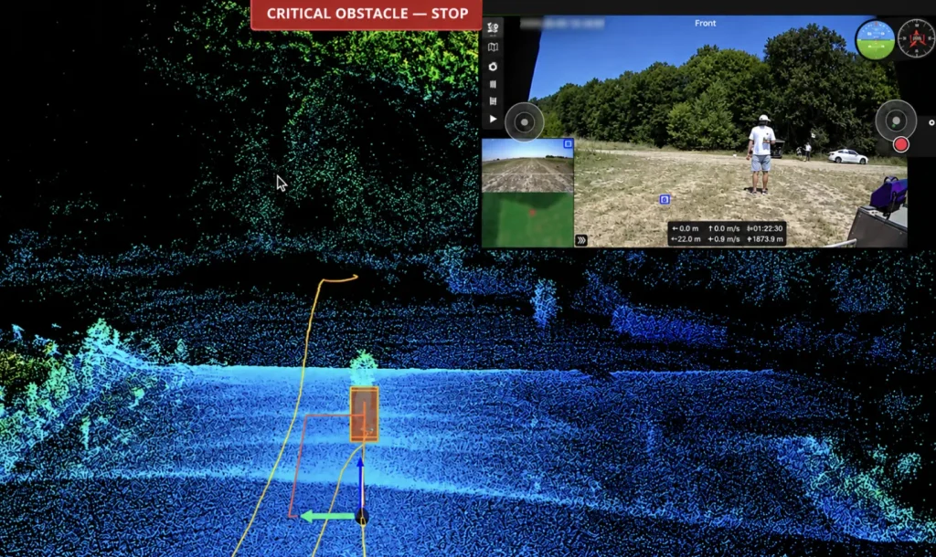
Farsight Vision emphasises that the module does more than simply show the operator a view of the area around the UGV: it also helps determine the vehicle’s position. The company describes the system’s operation in five steps:
- A 3D model of the terrain is created on the FSV Platform, providing a base layer to which sensor data can later be added.
- The module mounted on the UGV builds a point cloud around the vehicle as it moves, displaying obstacles and updating the route in real time.
- The operator can control the UGV in the usual way using a satellite map on the ground control station. By connecting the UGV with the navigation module to the FSV App containing the 3D terrain model, the operator can use it to cross-check the route.
- The 3D model is gradually supplemented with the point cloud as the UGV moves, giving the operator an increasingly accurate picture of where the vehicle is heading and what is happening around it.
- If the GPS signal is lost and the UGV becomes disoriented, the 3D model combined with the point cloud helps the operator quickly re-establish the vehicle’s position in the terrain.
“Our goal is to eliminate the need to deploy a reconnaissance drone solely to support a UGV, as this creates additional risk and consumes resources,” said Farsight Vision CEO Viktoriia Yaremchuk.
According to Yaremchuk, by the end of the year Farsight Vision plans to enable the UGV to autonomously return to the point where the connection was lost or to a designated base at distances of several kilometres. In the future, the developers plan to extend this range to 30–40 km.
Reading now
1
SkyFall officially unveils Thor Hammer mid-strike and announces 1,000+ km version
2
Pentagon to hold Drone Dominance trials for bomber drones, with UFORCE, Gurzuf Defence, Grim Tech and others taking part
3
Terra Drone acquires 50% of Ukrainian Kurin Technologies for $3.5 million
4
British-Ukrainian Occam Industries raises €3.8m. The funds will go towards scaling drone autonomy software
5

Frontline Robotics CBDO Mykyta Rozhkov: Ukraine and Norway are working on an autonomous system to protect maritime infrastructure
By submitting this form, you give Defender Media consent to the processing of personal data.
Надсилаючи цю форму, ви надаєте Defender Media згоду на обробку персональних даних.

Latest news
1
Farsight Vision unveils navigation module enabling UGVs to operate without GPS
2
Roboneers’ Saber remote-controlled weapon station to be integrated with Vepr UGV
3
Ministry of Defence codifies BlueBird Tech’s Bebradron strike UAV
4

Roboneers and German ARX Robotics sign strategic partnership agreement
5