

Intelligence dependence as a strategic vulnerability: From satellite constraints to autonomous analytical platforms
The Farsight Vision team on where modern intelligence systems are heading

The events of 2025 showed that satellite communications are not guaranteed to be stable: the large-scale Starlink outage in March and disruptions along the front line in September exposed the dependence of critical systems on external factors. This has intensified the debate about finding alternatives or complements to space-based intelligence systems.
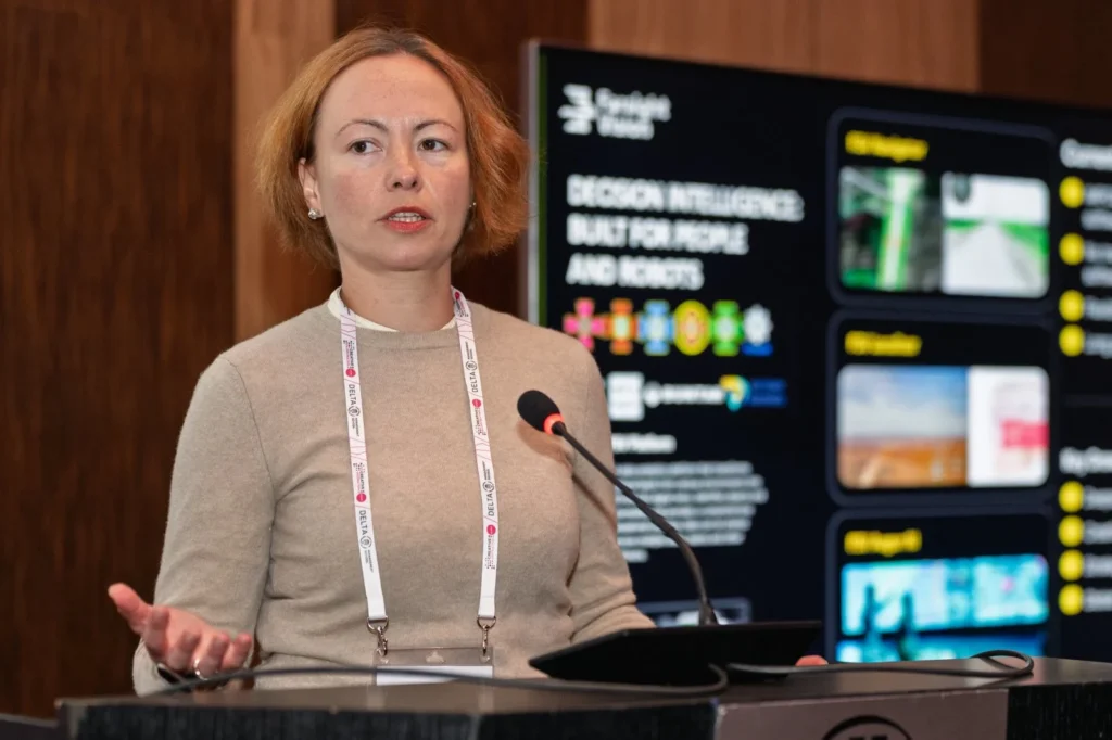
One of the projects working in this area is the Ukrainian-Estonian startup Farsight Vision. The editorial team at Defender Media asked the company to share its vision for the development of intelligence technologies and Farsight Vision’s role in this process. In the article, co-founder and CEO Viktoriia Yaremchuk and communications manager Myro Klochko explain which navigation solutions could serve as alternatives to satellite imagery.
Strategic constraints of intelligence support
In October 2025, Valery Zaluzhnyi’s article “60 by 60: Transforming Space into the Domain of Modern Warfare” outlined a systemic crisis in the Armed Forces of Ukraine’s strategic intelligence capabilities. The piece highlighted the absence of integrated oversight of intelligence processes, delays in data exchange, and a critical dependence on partner-provided and commercial space-based services.
The experience of the war has confirmed a central lesson: the mere availability of precision weapons is not decisive without the ability to rapidly obtain and process intelligence. What ultimately proves decisive is the tempo of the “detect – analyse – decide – strike” cycle. Delays at the intelligence stage directly translate into lost operational opportunities and allow the adversary time to adapt.
The space component as a variable factor
The events of 2025 demonstrated that satellite infrastructure cannot be regarded as inherently reliable. The large-scale global Starlink outage in March, followed by a loss of system stability along the frontline in September, exposed the extent to which critical command-and-control and communications systems depend on external factors.
Satellite services operate within the sphere of influence of political decisions, the corporate policies of private operators, and regulatory constraints. In a military context, this increasingly means the space component is evolving into a resource characterised by high uncertainty rather than a guaranteed element of the intelligence architecture.
Shifting the Focus to Autonomous Solutions
Under such conditions, the importance of autonomous intelligence solutions at the tactical and operational levels is steadily increasing. This does not imply abandoning satellite capabilities, but rather developing alternative tools that can operate independently of external services.
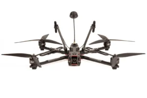
One example of this approach is the Farsight Vision analytical platform, which integrates UAVs, computer vision, and automated geospatial data analysis. Farsight Vision enables rapid transformation of drone imagery into high-resolution orthophotos and detailed 3D models, enabling swift detection of objects and changes on the ground.
Crucially, Farsight Vision is designed to minimise the time between data acquisition and decision-making — a critical parameter in the context of manoeuvre warfare.
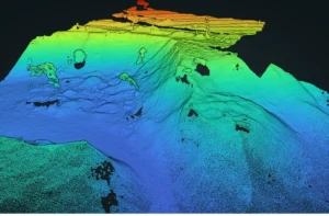
UAV-Derived orthophotos as a practical alternative
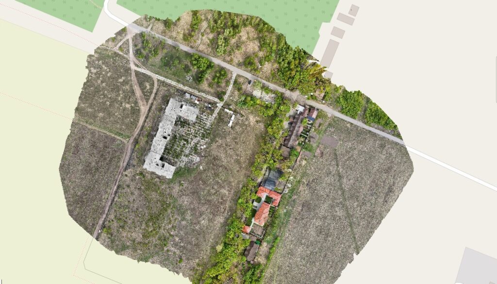
Compared with satellite imagery, the orthophotos generated by Farsight Vision exhibit fundamentally different operational characteristics. They are ultra-high-precision digital maps produced from large volumes of aerial imagery. In practical terms, this removes dependence on satellite overpasses and provides access to imagery with a level of detail that exceeds standard mapping products by an order of magnitude — revealing footpaths, small objects, and subtle terrain changes.
Satellite-based intelligence offers broad-area coverage and remains effective at the strategic level. However, it is constrained by fixed temporal windows, relatively long processing cycles (often up to 72 hours), and insufficient resolution for many tactical applications.
By contrast, Farsight Vision enables the creation of high-precision orthophotos without perspective distortion in a significantly shorter timeframe — typically within a few hours. Combined with UAV mobility, this allows for:
- rapid updates of the local terrain picture;
- operations under cloud cover;
- repeat imaging as required;
- the production of detailed in-house maps without relying on external data providers.
In the context of the Ukrainian–Russian war, these capabilities often carry greater practical value than global satellite coverage.
Operational role of Farsight Vision
Integrating Farsight Vision into intelligence processes enables the creation of an autonomous analytical layer that complements existing information sources. The platform can be used for:
- identifying objects;
- conducting anticipatory threat assessments;
- analysing changes in the disposition of enemy forces and assets;
- supporting tactical planning and near-real-time decision-making;
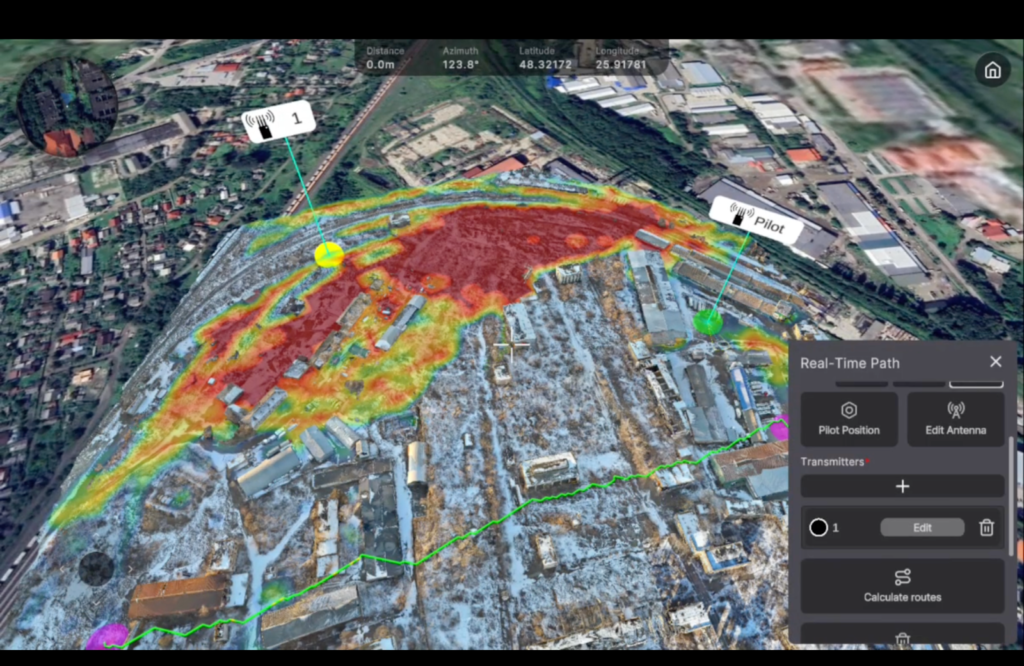
- operating under conditions of degraded or absent GNSS.
A key advantage of Farsight Vision is its ability to operate under conditions of limited access to satellite navigation and intelligence, reducing dependence on external political and technical factors.
Satellite intelligence remains an essential component of strategic analysis. At the same time, the experience of the war has shown that relying solely on space-based services creates a systemic vulnerability.
Recently, the article “French Space Intelligence: Where ‘Two-Thirds of Ukraine’s Intelligence’ Comes From” was published, claiming that France allegedly fulfils up to a third of Ukraine’s intelligence requests using its own satellites. While this is partially true, such estimates require important clarification.
The key “blind spot” in European space intelligence remains the absence of indigenous early-warning systems for missile attacks. At present, no European country possesses satellite assets capable of detecting ballistic missile launches in real time. This gap is filled exclusively by the American SBIRS (Space-Based Infrared System). As a result, despite the growing role of European partners, Ukraine’s dependence on US intelligence data remains immense and decisive.
As Ukraine and its European partners gradually move toward greater autonomy in space-based capabilities, it is critically important to ensure situational awareness across every square kilometre of the battlefield today. This entails combining high-precision information updated in near-real time, which is far more accessible and cost-effective than satellite imagery.
At the tactical and operational levels, information superiority is determined not by global coverage, but by the speed, accuracy, and relevance of data. Ukraine’s advantage lies in adaptability, rapid response, and high situational awareness.
In this context, the development of autonomous solutions — notably platforms such as Farsight Vision — enhances the resilience of the intelligence architecture, shortens decision-making cycles, and reduces critical dependence on external data providers. It is the combination of satellite and UAV-based analytical capabilities that delivers genuine information superiority at the tactical and operational levels of modern warfare.
Reading now
1

Ukrainian SkyFall’s drone wins at Pentagon’s Drone Dominance selection
2

Black Forest Systems raises $400,000. Here’s what drones the startup is building
3

Sting interceptor by Wild Hornets downs costly Russian Granat-4 reconnaissance drone
4
UForce unveils Bucha middle-strike drone with a 200 km range
5
The F10 drone becomes the second Ukrainian finalist in the Pentagon’s Drone Dominance Program
By submitting this form, you give Defender Media consent to the processing of personal data.
Надсилаючи цю форму, ви надаєте Defender Media згоду на обробку персональних даних.

Latest insights
1
What defence manufacturers need to know about Defence City — insights from the UCDI’s Head of GR
2

“In a year, my unit destroyed over 3,000 aerial targets.” Maksym Zaichenko on the 3rd Army Corps air defence system
3
Intelligence dependence as a strategic vulnerability: From satellite constraints to autonomous analytical platforms
4
A full-cycle unmanned business: Drone Fight Club founder Vladyslav Plaksin on manufacturing, pilot training, and investment
5